|
|
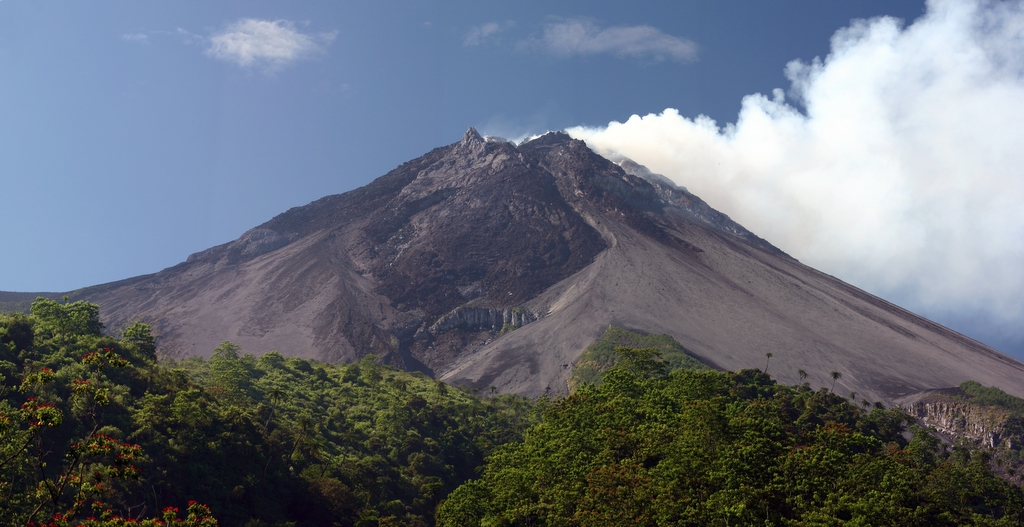
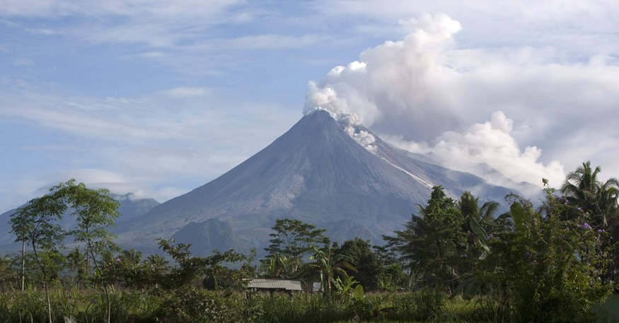
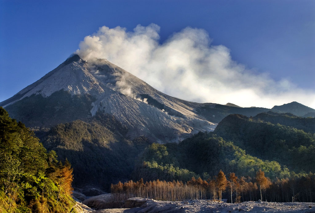
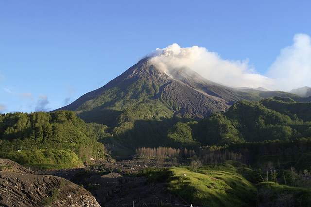
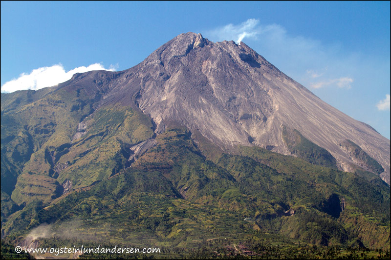
Eruption 25th November 2010
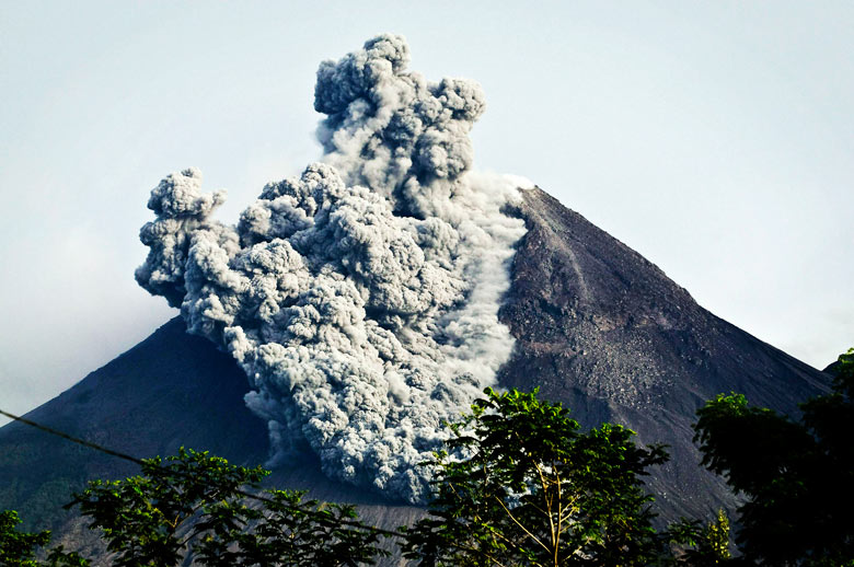
On 25 October 2010 the Indonesian government raised the alert for Mount Merapi to its highest level and warned villagers in threatened areas to move to safer ground. People living within a 20 km zone were told to evacuate. Officials said about 500 volcanic earthquakes had been recorded on the mountain over the weekend of 23–24 October, and that the magma had risen to about 1 kilometer below the surface due to the seismic activity. On the afternoon of 25 October 2010 Mount Merapi erupted lava from its southern and south-eastern slopes. The mountain was still erupting on 30 November 2010, however due to lowered eruptive activity on 3 December 2010 the official alert status was reduced to level 3. The volcano is now 2930 meters high, 38 meters lower than before the 2010 eruptions. After a large eruption in 2010 the characteristic of Mount Merapi was changed. On November 18, 2013 Mount Merapi burst smoke up to 2,000 meters high, one of its first major pancreatic eruptions after the 2010 eruption. Researchers said that this eruption occurred due to combined effect of hot volcanic gases and abundant rainfall. Why the eruption happened Merapi volcano is one of the world's most active and dangerous volcanoes. It contains an active lava dome which regularly produces pyroclastic flows. Eruptions occur at intervals of 1-5 years and are of low gas pressure. Since magma is poor in gas, eruptions are usually less than VEI 3 in size. Merapi is one of the most active volcanoes in Indonesia and has produced more pyroclastic flows than any other volcano in the world. It has been active for 10,000 years. Ash emissions reached an altitude of 40,000 ft, and 370,000 people were evacuated from a 20 km radius danger zone. Over 190 people were killed by pyroclastic flows and ashfall. |